| This is my English Blog | Indonesian Blog | Non-Serious Blog |
| Ini adalah Blog Inggris saya | Blog Indonesia | Blog Non-Serious |
View Blog using Dynamic View
Showing posts with label safety. Show all posts

Saturday, April 13, 2013

Lion Air 737-800 undershoots and ends up in the water

Lion Air flight LNI/JT904 flying from Bandung to Denpasar today ended up short of the runway and in the water this afternoon (13-Apr-13). The aircraft involved was PK-LKS, the aircraft is a Boeing 737-8GP with the possible serial number 38728, formerly used by Malindo Air for proving flights, the aircraft's first flight was 5 February 2013. The aircraft have only been in service with Lion Air Indonesia for less than since 28 March 2013 and appears to be a definite write off. The aircraft is also one of the few (if not the only) in Lion Air Indonesia's fleet that has a full In-Flight Entertainment on every seat by Panasonic.

PK-LKS ends up in the water short of the runway. Note the
perimeter fence is intact. (Source: Unknown via Twitter)
Contrary to initial media reports that stated the aircraft had overran the runway and ended up in sea, the aircraft never made it to the runway and instead of overshooting, it undershot the runway.

Weather at the time:
WADD 130730Z 15006KT 110V270 9999 FEW017CB SCT017 30/25 Q1007 NOSIG
(0730UTC/1530LT), Wind 150° at 6 knots varying from 110° to 270°, visibility more than 10 kilometers, few Cumulonimbus cloud at 1700ft, Temperature 30°C, Dew Point 25°C, Pressure 1007 milibars).

The Airport Ground Chart for Denpasar Bali (DPS). Note the geography for the western and eastern ends of the airport differ greatly.

Based on weather info at the time, and from ADS-B recordings of the flights preceeding and after the accident aircraft, the runway in use was runway 09. Overunning this runway would mean it should have crossed a major road and ended up in mangrove swamps and not in clear seas just off a runway!

Instrument Approach Chart for DPS 09
Based on ADS-B recordings, the following flights made their approaches for 09.

From 0550UTC:
- GIA439 KOEDPSCGK landed at runway 09.
- MAS851 KULDPS landed at runway 09.
- OZW251 PERDPS landed at runway 09.
- JST110 PERDPS landed at runway 09.

Following JST110 was LNI904. After LNI904 ended up in the water, VOZ4145 (SYDDPS) went around to 2000ft, and climbed to 3000ft and on hold at waypoint KUTA.
AWQ8497, held at 4000 at waypoint KUTA.
EVA255, held at 7000 at waypoint KUTA.
Possibly a CTV891 held at 5000 or 6000 at waypoint KUTA.
ADS-B recording of JT904 unfortunately was not enturely reliable, but it did show that VOZ4145 went around behind it.

Despite the past number of accidents and incidents at Lion Air, a significant safety improvements have been made over the past 5 years resulting in a huge drop in the number of mishaps per 10,000 departures for the airline.

Many are already asking if the accident was caused human error or mechanical or maintenance issues. While it is still early days, the following photo was sent to me reportedly from someone on duty at the airport at the time of the accident (the two aircraft was on hold), and if genuinely taken at around the time of the accident, can explain the weather information of the wind varying from 110° to 270° with that rain cell moving eastwards south of the runway centerline, carying with it some nice downdrafts (a.k.a. windshear).

Could this rain cell be responsible as one of the cuases of the accident?
Adding to the possibility of down drafts due to rain cells, approaching runway 09 also carry a risk of visual illusion. The lack of ILS (Instrument Landing System) and approach lights for the runway (the lack of the latter due to geography and ecological reasons), with only the PAPI (Precision Approach Path Indicator) as a cue of one's incoming slope on the visual part of the approach, raises the risk of losing depth perception, which in turn increases risk of undershooting the approach.

Whatever the causes, reasons, speculation, let the National Transportation Safety Committee investigate the accident. For me personally, I suspect the windshear and or the usual unstable approach as possible causes for this accident, but we must thank the low tide at the time of the accident as it certainly contributed to the high (100%) survivability rate of this accident.

Sunday, January 20, 2013

Benign but Deadly: Sukhoi Superjet Accident Conclusions

A version of this article in Indonesian was published on 10 January 2013 at Sindo Weekly magazine with the title of "Sepele Berujung Petaka." A link to the article will be put here when it becomes available.

With today's ever increasing levels of safety, the cause of any subsequent accident becomes seemingly benign or more mysterious. Improvements in safety is done by mitigating the easier of the high-risk factors, before moving on the more difficult and the cycle is repeated as we move to the medium-risk factors and then the low-risk factors. This is how we end up enjoying today's high levels of flight safety.

Seemingly benign or mysterious and difficult to understand?
The final trajectory that raised
many questions. (Source: NTSC)
Was this Sukhoi accident caused by mindbogglingly simple and seemingly benign factors or mysterious and hard to understand factors? Trying to explain why a high-tech aircraft with no malfunction can hit a mountain when piloted by an experienced crew is hard enough, explaining the factors behind it is more difficult. Explaining that it is caused by seemingly benign factors, can seem futile, even though it is important.


Speculation arising in the past include bombing, hijacking, or doing those hair-raising maneuvres that is normally reserved for airshows, are simply plucking dreams out of the air to get a quick  and easy answer. As these shortcut answers prove to be unsuitable as more facts are known, the blame-game ensues, and it is always easier to blame the dead than it is to fix those of us who are still alive to prevent us from making the same mistakes.

The final investigation report by Indonesia's National Transportation Safety Committee (NTSC) on the Sukhoi Superjet accident that occured on 9 May, was finished and released in a world record-breaking 6 months and 1 week. The report itself covers a lot on the seemingly benign factors causing or contributing to the accident, which people find hard to accept and tend to simply blame the dead, but what can we learn and fix from this accident?

Benign but deadly! 
A Visual Flight Rules chart provides good
information on the topography and is useful
for both cross-country and local area flying.

(Source: NTSC) 
The simplest question arising from this accident is how did the crew not know there was Mount Salak that they end up hitting? The NTSC report reveals that the preparation for the demo flight was grossly inadequate and poorly coordinated, in particular on risks due to the local topographical. The flight was initially planned to reach out to 20 nautical miles from Halim on a radial of 200 degrees. This plan was rejected prior to the first demo flight by the Halim Briefing Office, and the plan was changed to plan to go to Pelabuhan Ratu area, which was 30 nautical miles further out. However, the first flight ended up only as far as it was originally planned, 20 nautical miles on a radial of 200 degrees from Halim. On the second flight, the crew assumed that the route would be the same, as in reach 20 nautical miles out and returning. However, the Air Traffic Control (ATC) in Halim heard a conversation in the Briefing Office, that the first flight occured above Bogor Area, and that information was forwarded to the Approach Controllers. Two different perceptions occured on where the flight was going with ATC assuming Bogor Area and the crew assuming 20 nautical miles at radial 200 degrees. Coincidentally, 20 nautical miles at radial 200 degrees, is above and in the middle of Bogor Area. Who would have thought the existence of the two differing assumptions was one recipe for disaster?

The next benign factor was the improvisation of the aircraft type that was entered into the Flight Data System of the ATC network and reveals the lack of coordination between the ATC and other segments of the Air Traffic Services. One can understand that the improvisation was inevitable when the Flight Data System database does not have the Sukhoi RRJ-95B (the official designation of the Sukhoi Superjet), and the Flight Data Officer entered the Sukhoi-30 as the aircraft type into the ATC system. While the manufacturer is the same, Sukhoi, one is a passenger transport aircraft, the other is a highly maneuverable combat aircraft. Who would have thought that this improvisation forms the next benign recipe for disaster?

The En-Route chart used by the aircraft crew and is not
suitable as a source of topographical reference due to
its scale. It is apparent that this chart does not show
the Minimum Off-Route Altitude (MORA). 
(Source: NTSC)
The types of charts carried, forms the next benign factor. The crew carried an en-route chart which is suitable for intercity flying instead of a local area flight. Although it does show basic topographical information, the scale of the chart makes it literally impossible to accurately measure a distance of 20 to 30 nautical miles and shows Mount Salak further south than its actual  location. During the briefing the crew was not given any other chart apart from the approach chart (which only covers the immediate vicinity of the airport). No low-level Instrument Flight Rules chart or Visual Flight Rules chart was given. Not having a suitable chart showing where the terrain was, is another benign but fatal causing factor.

These three benign factors, on their own, would not cause a perfectly healthy aircraft and an experienced crew to hit a mountain. However, put these three factors in a row, and the risks posed to the flight went up exponentially.

A Low-Level En-Route Chart that shows the MORA and
the locations of Training & Restricted areas at low
altitudes which are more useful than High-Altitude
En-Route charts for low-level IFR flying.

(Source: NTSC)
3 benign factors in a row.
The ATC officer monitoring the flight authorized the descent from 10,000 feet to 6,000 feet because he received information that the flight was to be conducted at Bogor Area where there is the Atang Sanjaya Training Area with an upper limit of 6,000 feet.

The descent to 6,000 feet in obscure weather conditions was not a concern because on the screen, the aircraft was showing to be a Sukhoi Su-30 combat aircraft which would have a different set of operating rules to civil transport aircraft. 

By not carrying the suitable charts for the flight, the crew would not be aware how close they are to the mountains, in particular to Mount Salak, and it is likely that the crew never even knew there was a mountain where they were heading due to the inadequate area briefing.

Forget blaming the dead, let's focus on the homework for the living.
These three seemingly benign factors became the foundation of the tragedy on 9 May 2012. This accident can be categorized as human error, but the error is not limited to the ATC officer monitoring the flight, nor is it limited to the crew (pilot error). Before we blame the crew for switching off the Terrain Awareness and Warning System (TAWS) when it was giving its warnings, or blame the guest in the cockpit, we must remember that they can no longer make the same mistake again because they're dead.

What we, the living, need to do is the act on and rectify the errors causing these, at least, three seemingly benign factors because, the person who was giving the briefing that day, the person who entered the aircraft type into the Fligth Data system, and the person who didn't give the crew a more suitable chart to be used, are all still alive. We need to improve our working system and work ethos, and theirs, so these seemingly benign factors will no longer be the foundation of a future disaster.

Note:
The Final Report for the RA-97004 Accident Investigation can be found HERE and HERE.

Thursday, June 21, 2012

Indonesian Air Force Fokker-27 crash near Halim Airport

Updated 20120621/1230UTC
Updated 20120621/1240UTC
The aircraft was seen doing a steep bank shortly before crashing
(Photo by: Pasya)
An Indonesian Air Force Fokker-27 crashed near Halim Airport in Jakarta this afternoon, Thursday 21 June 2012. The aircraft involved is reported to be A-2708, and the Air Force had since confirmed that there were 7 persons on board, all except the co-pilot had died, in addition to 3 known fatal ground casualties (2 children and 1 adult). The co-pilot is still in intensive care at the airbase's hospital. There are also 4 other ground casualties still buried under the aircraft whose status is not yet known.

From eyewitness report, aircraft appeared to have crashed whilst trying to go-around. The witness, a former student pilot, reported that the aircraft's left wing had dipped down just before touchdownon runway 06, which was then countered and the aircraft performed the go-around. Unfortunately, the change in direction brought the aircraft's right wing 'very close' to the airport control tower. In an appeared attemted to avoid the collision with the control tower, aircraft banked to the left again and then crashed. NOTE: THIS EYEWITNESS INFO ABOVE CANNOT BE INDEPENDENTLY VERIFIED!

Several houses caught fire in this accident
(source: Ahmad)
The aircraft crashed into the air force base housing complex on the north side of the airport, destroying 6-8 houses and caused a fire. A photo of the aircraft shortly before the crash, shows a steep left bank with both engines running. However there are unconfirmed rumours that the aircraft had an engine failure with a failed propeller feathering. It is unclear at what stage in the flight did this occur.

Weather at Halim (latest METAR at 9am local time was: WIHH 210200Z 00000KT 5000 HZ NLC 28/23 Q1013 NOSIG) are not available but conditions were adequate for VMC flight with over 5 kilometers visibility and no low cloud. Around 1 hour prior to the accident, I also saw an Air Force C-130 Hercules performing high level circuits on the west side of Halim.

Several photos of the crash site has also come to surface.

(Source: Unknown)

Friday, June 1, 2012

Sriwijaya Air 737-400 runway excursion at Pontianak

Sriwijaya Air Boeing 737-4YO PK-CJV just had a runway excursion upon landing at Pontianak Airport. Initial reports indicate all crew and passengers are save, and aircraft is "in one piece". Aircraft was doing SJ188 Jakarta-Pontianak (scheduled departure 1035LT, scheduled arrival 1200LT). Accident occured at around 1230 local time, extent of damage unknown at this stage. The crew have so far been identified as a local instructor captain and a foreign junior pilot undergoing line training, with a a local first officer acting as safety pilot.

PK-CJV after evacuation at PNK
Pontianak Airport is now closed as per the following NOTAM:
  • B0726/12 NOTAMN
  • Q) WIIF/QMRLC/IV/NBO/A/000/999/0008S10924E005
  • A) WIOOB) 1206010600 
  • C) 1206011200
  • E) RWY 15/33 CLSD DUE TO BLOCKED BY ACFT
  • CREATED: 01 Jun 2012 06:01:00 SOURCE: WRRRYNYX
  • (From http://www.notams.faa.gov)


Weather conditions at around 1230 local time is as follows:
WIOO 010530Z 23022KT 0600 FEW009CB BKN007 29/25 Q1008 RMK CB OVER THE FIELD
  • Pontianak Supadio Airport, Date 1(June), 0530UTC.
  • Wind: 230 at 22 knots
  • Visibility: 600 metres 
  • Cloud: a few clouds at 900 feet with cumulonimbus 
  • Cloud: broken at 700 feet
  • Temperature: 29 C 
  • Dewpoint: 25 C
  • Humidity: 86%
  • Pressure: 1008 hPa
  • Remarks: Cumulonimbus over airfield


Weather conditions at around 1300 local time is as follows:
WIOO 010600Z 3000 TSRA FEW010CB BKN008 24/24 Q1007 RMK CB TO NE
  • Pontianak Supadio Airport, Date 1(June), 0600UTC.
  • Wind: No Information
  • Visibility: 3000 metres 
  • Weather: thunderstorm with rain 
  • Cloud: a few clouds at 1000 feet with cumulonimbus 
  • Cloud: broken at 800 feet
  • Temperature: 24 C 
  • Dewpoint: 24 C
  • Humidity: 100%
  • Pressure: 1007 hPa
  • Remarks: Cumulonimbus to the northeast
No wind information suggest that heavy localized weather pattern may be a factor.

Updated 0708UTC. Added Flight Number, Phase of Flight, Flight Schedule, Time of Accident.
Updated 0725UTC. Corrected minor details.
Updated 1355UTC. Crew composition update.

Tuesday, May 29, 2012

SSJ100 Accident: Minister reveals the timeline


The Minister stated that the flight plan for the ill-fated second flight was an Instrument Flight Rule flight plan from Halim Airport, to the Pelabuhan Ratu area and back, with a planned altitude of 10,000ft. The flight was planned to take around 30 minutes.

Timeline
0710UTC aircraft requested engine start.
0721UTC aircraft took off from Runway 06 and climbed to 10,000ft.
0724UTC aircraft contacted ATC at Soekarno Hatta airport along radial 200 from Halim VOR (VHF Omnidirectional Range beacon).
0726UTC aircraft requested to descend to 6,000ft.
0728UTC aicraft requested to make a right orbit over Atang Sanjaya (Bogor) Training Area.
0752UTC ATC attempted to call aircraft as it disappeared from radar.
0755UTC ATC reported the missing aircraft to the Air Traffic Service Coordinator.
0835UTC SAR "Uncertainty Phase" declared.
0905UTC ATC contacted Search and Rescue
0955UTC SAR "Alerting Phase" declared.
1122UTC "Distress Phase" declared after aircraft endurance time elapsed.

My flight path analysis/speculation of accident in Part 2 of article series
is very similar to the official statements made so far.

My Remarks
This corelates with my analysis at SSJ100 Accident: Innovent but Deadly Part 2Everything up to Point 3, matches. However, the descent from 10,000ft does NOT make sense if they planned to go to the Pelabuhan Ratu area, which is about another 25 nautical miles from where the aircraft did its orbit.

Based on this, a rough descent profile analysis can now be assembled, which will be put in Part 3 of the the "Innocent but Deadly" article series. (To be updated/linked here)

Saturday, May 26, 2012

Batavia Air - In trouble? (Part 1)

A few days ago I tweeted that I heard 2 Batavia Air A320s having been repossessed by its lessor. It all started when I received a message early this week that several cabin crew and pilots have started saying privately that the airline was about to go bankrupt, with about 4 - 5 737s to be returned, and the 330s as well, and that the chief pilot had resigned.

No Cash?
I called up my sources, whilst they were chasing up the information, rumours, leads and leaks, I came across this article at TempoThe article dated 19 May revealed that 3 days beforehand a Batavia Air flight was delayed (by 5 hours after it was scheduled to depart, the flight, assumed to be from Pontianak to Jakarta). The passengers had decided to bring the airline's station manager to the airport security, and at the security office, a passenger stood up and addressed the other passengers.

"The problem here is that Batavia Air does not have the cash to compensate us in accordance to the regulations. In order for us to go home and rest, I am going to help Batavia Air."

Batavia Air at the airport had only IDR 16 million in cash, and the compensation that was due amounted to IDR 44 million. The passenger, Rasmidi, head of the Ketapang Regency Chamber of Commerce, then said, "I will cover the rest, please register yourselves to obtain the compensation. "I hope this serves as notice to Batavia Air, to reduce its flight schedules to match the small fleet that can operate."

It seemed that Batavia Air had overstretched its schedule.

Planes parked, or missing, and frequencies reduced: Signs?
As I wondered why on earth would Batavia Air not have cash for delay compensation, got to the airport the next day, and found both Batavia A330s parked together at the remote apron. This obviously raised alarm bells in my head, and prompted me to call up my sources again. By the evening, various sources began providing information. 

PK-YVF spotting at Singapore Changi devoid of titles
(Photo by: M. Aswin)
Another (ex-) Batavia A320 devoid of titles in Singapore Changi.
This one is suspected to be PK-YVH. (Photo by M. Aswin)
  • 2 Batavia A320s had been seen in Singapore, also parked together at the remote apron. Later I received pictures of the airplanes, both have had their logo and titles removed. The aircraft had been in Singapore since at least 16 May according to sources. One is identified to be PK-YVF and the other is suspected to be PK-YVH as the pair are reportedly leased from CIT.
  • 1 737-400, PK-YVQ is reported to have been returned to the lessor.
  • Both A330-200s are reportedly being prepared to be returned to lessor.
  • Another sources, had said that Batavia have reduced its flight frequencies on several routes by at least 1 flight a day.

Allegations, allegations and allegations - Is Batavia in trouble?
There have been numerous allegations of safety violations/breaches against Batavia. Most of the allegations in the past have been on the subject of crew flight hour limits being exceeded, whether weekly, monthly, or annual limits, are so many that I've lost count and stopped trying to remember them. The last time I heard of the allegation was if I remember correctly, when it was alleged that a DGCA inspector asked a Batavia pilot at Jakarta's airport waiting for his crew transport home, to show his flight log book, to which it was found that the crew had violated one of the periodic flight hour limitations. This reportedly led to immediate removal of the Operations Director.

Past allegations have also included questionable operational decisions, such as the company's route to Luwuk, where former crews claimed that they were not given charts of Luwuk Airport and that the procedures for route and the airport was made up as they go along. One or two allegations regarding operations of aircraft with no-go maintenance issues have also been made (one claim involved an A320 being dispatched on a single IRS, and another claimed that weight limits were exceeded).

Note: The above are allegations and cannot be independently verified.

Poor Maintenance cause delays. A delay (that is not caused by weather or factors beyond the control of the airline which does not include maintenance) exceeding 3 hours now require IDR 300,000 (about US$32) per passenger, cash compensation to be given to the passengers. If an a 737 has 10 flights a day, and each is delayed by over 3 hours, that's US$47,000 to US$55,000 in cash compensations. That amount is about the same as the monthly dry lease rate of an early 1990s built 737 classic. It takes no genius to figure out that delays caused by maintenance, is extremely expensive!

The overrun at Balikpapan in March was the second incident
involving the aircraft in the last few months.

The allegations mentioned above, are very hard to prove. We can believe in them or dismiss them as the claims aren't independently verifiable. However, the findings by the NTSC on the recent A320 runway overrun at Balikpapan ("Update: Batavia A320 Overrun at BPN 12Mar12" (dated 23rd April 2012)), does provide insight into the potential problems. The NTSC found that:

  • Batavia had not maintained the aircraft (involved in the incident) in accordance with the Airbus service bulletins, or even, Airbus's recommendation regarding rectification of the cause of the previous incident involving the aircraft. 
  • It was also revealed that the airline disregarded the Airbus recommendation for the problem on the brake servos be solved prior to its next revenue flight (after 1st incident at Jayapura) 
  • It was found that the airline's Technical Director was different from the Ops Spec submitted and approved by the DGCA.
The NTSC findings above are NOT allegations, they're not in the business of making allegations.

A330 Ops: Batavia's most descriptive bungle
Batavia made a bid in the 2012 Hajj tender. The airline had submitted its bid, which includes utilizing both of its A330-200s, and leasing 4 A330-300/A340-300 from Air Asia X, and 1 777-200 from EuroAtlantic, however Batavia also admitted they had not had any agreements regarding those leases because it was waiting for a decision from the Ministry of Religious Affairs before making commitments on the leases. The Ministry then announced that Batavia had not met the required qualifications specified in the tender documents, which included LOIs to show adequate commitment (ie: "not bluffing") on leases and also possession of IOSA certification. Batavia had none, and can only meet 7 of the 11 qualification criterias .

Batavia then lashed out claiming monopolistic malpractice as a reason for its failure to win a spot in the hajj flights. "This is not the first time we’ve proposed the service and not won," commercial director Sukirno Sukarna said to Jakarta Post, adding the airlines had tried in the past several years to win the haj transportation tender. But the Jakarta Post article showed that Batavia does not understand the tender: 
  • Last year Batavia had  its bid rejected because it did not have landing permits for the Hajj flights or had not applied for it, Batavia rejected such notion, claiming that it had the landing permits for Jeddah (except that it is for tourist and business (ie: regular scheduled) flights, and not Hajj flights which is a separate permit).
  • Instead of obtaining LOIs for aircraft leases, Batavia instead provided a loan commitment from a bank amounting to $1.3 million to lease aircraft for the hajj flights (something which is grossly inadequate, even for 1 aircraft!)
  • Instead of obtaining an IATA Operational Safety Audit (IOSA) certification, they said that "we have secured an ISO certificate that guarantees our service and safety. That is the same," according to Batavia's commercial director Sukirno Sukirna. DGCA spokesman Bambang Ervan had to explain to the media the difference between an ISO and an IOSA.
  • The ISO/IOSA games played by Batavia, isn't bought by anyone, because in March, Batavia actually said they were after the IOSA and that they were going to commence the process in 2013, and that Sukirno Sukirna stated that one of the reason is to be able to qualify for the Hajj flight tenders.
Outside of the Hajj bids, the A330-200 operations into Jeddah and Riyadh had seen poor load factors. Batavia initially announced it would fly to Haneda and has recently announced it would delay opening the route citing rising fuel costs as a reason (shouldn't they have factored in this?). If the A330-200s end up being returned to the lessor, I would not be surprised, in fact, such a move could actually save Batavia Air, but this doesn't answer the question as to why the 2 A320s are being returned.

So, who's pulling who's leg?
To conclude all the above briefly, I will add that around a year ago, a source from the financial industry mentioned to me that the airline's balance sheet was in a total mess, with negative cash flow all the time. He estimated that unless something changed, Batavia would run out of cash in about 11 months. The 11th month, was to be May 2012. If Batavia is indeed in trouble, would Rasmidi, who saved Batavia Air's station manager from being arrested or clobbered by Batavia passengers, get his money back?

Whatever is happening in there, hiccups do happen, and sometimes spectacularly when it comes to Indonesian airlines, but my hope remains: That the airline improve, turnaround, and come back as a strong and healthy player in our ever growing market. We don't want another Adam Air here!


Part 2 can be found HERE

Friday, May 25, 2012

SSJ 100 Accident: Mythbusting the US Sabotage Theory


I didn't expect this to be bigtime news, but I guess since the rapid pace of development surrounding the Sukhoi Superjet 100 crash has slowed down, old rumors begin to surface. This time, the allegation of SABOTAGE.

Today, I read a tweet from Olga Kayukova (@Olga_Kayukova (Russian) / @Olga_Kayukova_e (English), Head of Communications, United Aircraft Corporation.

I'm amazed at how Olga can keep her cool over the past few weeks, with the amount of crazy speculation that has been raised.
  • "In our comments we rely only on the official investigation process. The media invents totally insane stories, another media repeats."
  • "Nobody in Sukhoi nor in UAC spreads or supports crazy ideas. It's speculations."

How did this sabotage rumor start?
It was reported by many witnesses, that on the day of the crash, a USAF C-17 arrived at Halim Airport, and parked on the South Apron (where the Russian Il-76s were parked during the salvage efforts). After the aircraft disappeared from ATC radar, the C-17 left departed.

USAF C-17 parked at Halim's Southern Apron
Photo also available at Jetphotos.
It certainly sounds fishy, and several journalists also asked me whilst interviewing about the circumstances around the accident. Since no one speculated further on the sabotage, I decided not to write about it, that is until I saw Olga's link to the Daily Mail article today.

"'We know that they have special technology - that we also have - to jam signals from the ground or cause parameter readings to malfunction,' said the unnamed intelligence official, highlighting a US military presence at Jakarta Airport from where the plane took off on May 9."

The facts as I know it - USAF Diplomatic Mission Support Operations
The US Air Force provides diplomatic mission support flights. 1 (a C-12 / King Air executive turboprop aircraft) is based in Halim in case Jakarta ends up in a riot that key diplomatic staff have to be evacuated. This aircraft runs around Halim airport regularly, but this was not what was reported during the day.

USAF C-12 stationed at Halim for Diplomatic Support Missions
Photo also available at Jetphotos.
The US Air Force aircraft present in Halim that day was reported as a C-17. How coincidental, SSJ-100 in Jakarta, at the same time the C-17 turned up. But, it's nothing more than a coincident. The USAF C-17 regularly fly to Halim Airport (once or twice a month, but no less than once every 3 months, depending on the agreement between the Indonesian and US Governments), also to support the US diplomatic mission in Jakarta. The aircraft would land, and park at the southern apron, offload stuff, and then onload some stuff, refuels, and depart again. Often, they spend about 1 - 2 hours before departure seemingly doing nothing.

What does these "support flights" do?
Simple: Emergency supplies for the embassy. The US Embassy, has emergency ration supplies in case of war or civil obedience. The amount of foods and supplies they keep, is not for me to know or disclose, but those supplies have to be rotated regularly, and the rotation require a closed-loop secure supply chain. That is why they had to use the USAF to support this supply rotation. 

Furthermore, the US does not want a repeat of the "Embassy Scandal" that happened in Iran, where shredded and destroyed documents were painstakingly reconstructed by the Iranians and then published as "Documents from the US Espionage Den" (اسناد لانه جاسوس امریكا), which contained information that are still classified by the US even today. One of the tasks was to evacuate shredded documents for secured destruction. I am told that when the aircraft has completed off loading supplies, re-loaded it, and then refuelled, one of the reasons for waiting around for an extra hour or two, was to wait for the last batches of "shredded documents" to be airlifted. And no, these documents are not carried in trucks, it can be as simple as someone with a small back pack, inconspicuously entering the aircraft, and leaving the aircraft without it.

I've seen several of these flights come in and out of Halim, especially back in the days when I flew in and out of Halim to the south coast.

They're just standard C-17s. No non-standard fancy gizmos put on them. The US is more scared of losing its secret technology in a plane crash caused by poor fuel quality being provided by civil suppliers (eg: Pertamina at Halim Airport). Observers of the military signals, intelligence, and counter-intelligence equipment in aviation know that to bring down an airplane such as the Superjet-100 in "mysterious circumstances", require lots of fancy gizmos, and at sizes that would make it obvious the aircraft carrying the gizmos are not a standard one!

My opinion remains, this USAF C-17 aircraft present at Halim that day, was a non-issue in this accident. Even a staunchly anti-American journalist interviewing me could accept that. I told him it would be far easier for anyone to bring the airplane down through other means (hey, ex-Soviet MANPADS are reported to be widely available in the blackmarket!) and getaway with it.

Wednesday, May 23, 2012

SSJ100 Accident: Was there a local pilot on the flight deck?


Controversy and coverage of the Sukhoi SSJ100 crash continue, albeit now not continuously in the headlines. One point that people continue to ask me is: "Surely the Sukhoi crew the risks associated with the local geography, didn't any local pilot join the flight crew in the cockpit?"

Answer: YES, the first flight had a local pilot in the observer seat in the cockpit.

Photos of the 1st demo flight showed a Capt. Setyaki from Sky Aviation occupying the observer seat. However, little is known on what capacity did he occupy that seat. Was it to assist the flight crew? Provide area familiarity cues/pointers? Or purely to enjoy the flight.

Whatever the reason, the fact remains, he was there. Even if he was there purely as a "previledged passenger", his presence would surely be able to add a pair of eyes to watch out for "unique local risks."

Approaching AL, with Capt. Setyaki on the jumpseat taking photos himself

Fortunately or unfortunately (depending on how you look at it), he wasn't on the second flight. I am sure that any information given by the jumpseat occupier with regards to the local area would be useful for the flight crew. 


However, whether that information or his presence on the second flight could/should have prevented this accident or not, is questionable. After all, even my friends who fly in and out of Jakarta's main airport everyday and fly over Halim as they head to the east said, they don't know exactly how far the distances are from Halim to Mt. Salak and Mt. Pangrango, as it's not on the airway they frequent. They'd also think in zones, much like what's depicted on the charts, such as MSAs (Minimum Sector Altitude) and MORAs (Minimum Off Route Altitude), which also provide some cushion of obstacle clearance. Capt. Setyaki at Sky Aviation, don't normally fly in and out of Jakarta anyways, Jakarta isn't on the route network for Sky Aviation, so his pointers would be "general" albeit complete.

Would a sightseeing pilot in the observer seat know where the airplane was? Sure! I'm not a pilot, and even I can read the navigation display and the horizontal situation indicator below the artificial horizon, and obtain a quick picture on where the aircraft was in this photo:


First Officer's Panel (Photo by Andy D / @infohots)

My opinion remains that, a local pilot present in the flight deck on the second flight may not have prevented the accident, unless you put someone who is familiar with the area (which are air force pilots (and mainly helicopter pilots from Atang Sanjaya), or instructors and student pilots based in Halim who frequently use the Bogor Training Area) in both Visual and Instrument Flight Rules. The latter two types of pilots, aren't the usual guys companies want to put in the flight deck on a sales demo flight of a new commercial airliner.

Thursday, May 17, 2012

SSJ 100 Descent: Innocent but deadly - Part 2

Note: To add further understanding on the theory / speculation contained in this article, I strongly recommend those who have not read the previous articles SSJ 100 descent: Innocent but deadly - Part 1 and SSJ 100 crash site: The worst place in the whole mountain, to do so.

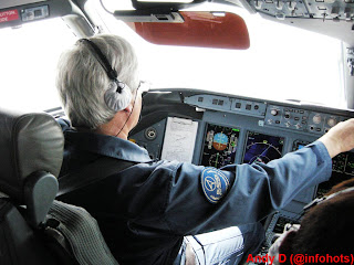
I was very unsatisfied with the results I got from the first round of trajectory simulation for the SSJ-100 crash in Jakarta a week ago (blog article here: SSJ 100 descent: Innocent but deadly - Part 1). It does not match the crash site. I tried to find the cockpit photos by my friend Andy D (@infohots) who went on the first flight, to no avail. I felt that extrapolating based on the First Officer's panel alone is really a waste of time. No matter how I try to find alternatives, I keep coming back to the same conclusion.

All that changed today when Andy turned up again on the net and posted at the SSJ-100 crash topic in Indoflyer, and that he contacted me as well. His photos in Photobucket ran out of bandwidth and he loaded it elsewhere. I asked him to send the originals to me, so he did, along with what he can remember from his flight. It changed everything!
Captain's Panel (photo by Andy D/ @infohots)
The Captain's Primary Flight Display showed basically the same thing as the first officer's, and the detail of the new photos corrects a few errors I made:
  • Aircraft Indicated/Calibrated Airspeed: 238 knots
  • Aircraft was passing 7300ft (the difference with the other photo is only a matter of timing)
  • Autopilot was on, with Heading Select mode and Vertical Speed mode (029° and -1300 feet per minute), Altitude Select was 6000ft (not 2500).
The major difference in finding is on the Captain's Navigation Display:
  • Aircraft's Flight Management Computer was programmed and at the the aircraft was tracking towards a pseudo-waypoint called AL01 (position is roughly 150° at 3 nautical miles from AL Non-Directional Beacon)
  • The cyan coloured dashed-line, is actually a course-line from Halim VOR, with the selected course inbound of 241° which would put it very near the the Instrument Landing System localizer centerline for runway 24.
  • The display range is set at 40 nautical miles, giving the dashed white arc a distance of 20 nautical miles from the aircraft. This differs from the First Officer Navigation Display, set to 20 nautical mile range.
  • The green line showing the aircraft's planned track, forward of the aircraft is the same as the First Officer's, BUT, the difference (thanks to the larger selected display range), shows that the aircraft had only been going straight for 15 nautical miles or so. This contradicts the previous assumption of 25 nautical miles or so in the previous article.

First Officer's Panel (Photo by Andy D / @infohots)

A closer look at the First Officer's Navigation display, also reveal some changes. The cyan coloured dotted line, does not represent the previous flight path (this was a VERY stupid mistake for me to make!), as mentioned above, it is a course-line from Halim VOR. The previous article assumes that the line was tracking a course of 195°. Closer inspection, and some revised analysis reveals that the course line was selected to 200°.


These findings, invalidates the planned flight path assumptions made in the previous article. The revised assumption of the flight path of the first demo flight is:
I have decided to not clutter the map with my writing, but marked key items in the map.


For the Cyan coloured items:
 1  A line depicting a course of  200° outbound from Halim VOR.
 2  A 20 nautical mile radius ring.
 3  AL Non-Directional Beacon.

The Magenta coloured items:
 1  Aircraft took off from runway 24, and made a left turn to the southwest towards Bogor Training Area while climbing to 10,000ft.
 2  Entering Bogor Training Area, aircraft turned left to the east.
 3  A right-hand orbit (360° turn) was made at position HLM200/20 (20 nautical miles from Halim VOR on radial 200°).
 4  After completing the orbit, aircraft leaves Bogor Training Area towards AL01, and begins to descend to 6,000ft sometime after completing the turn.
 5  Approximate position of aircraft when the flight deck photos were taken (Near radial 150° at 10 nautical miles from Halim VOR), as aircraft descended towards 6,000ft. Aircraft then descended further along the magenta line until on the ILS for runway 24, and landed.

Note: Bogor (Atang Sanjaya) Training Area (WIR4) coordinates for those interested, are: 06°31'00"S 106°30'00"E, 06°31'00"S 106°50'00"E, 06°38'00"S 106°50'00"E, 06°38'00"S 106°30'00"E, 06°31'00"S 106°30'00"E, and extends from the Ground to 6,000ft.

This is hugely different from what was written in my previous article, but this is based on Andy D's story, which I view as reasonably accurate. We also know that the second flight, took off from runway 06. Just like in the previous article, I am assuming that at least one waypoint remains the same: HLM200/20 (20 nautical miles from Halim VOR at radial 200°).

My assumption of the second flight:

For the Cyan coloured items:
 1  A line depicting a course of  200° outbound from Halim VOR.
 2  A 20 nautical mile radius ring.

The Magenta coloured items:
 1  Aircraft took off from runway 06, and made a right turn to intercept the Halim VOR radial 200° whilst climbing to 10,000ft.
 2  Aircraft continued on a course of 200° and reached 10,000ft, to enter the Bogor Training Area. The request to descend to 6,000ft and the right hand orbit would be made shortly after this.
 3  After entering the training area, a right-hand orbit (360° turn) was made at position HLM200/20 (20 nautical miles from Halim VOR on radial 200°), and the aircraft also descended to 6,000ft. Note: This should keep the aircraft within the training area throughout the orbit turn.

What should have happened then:
 4  After completing the orbit, aircraft leaves Bogor Training Area on the same heading before performing the orbit, and it is to obtain Air Traffic Control (ATC) Clearance to head back to Halim for the approach to runway 06.
 5  Aircraft would continue to descend to 1600 until performing a visual approach to runway 06, or reach the position of HLM250/5 (5 nautical miles from Halim at radial 250°), and land.

We know points 4 & 5 never happened because the aircraft never made it back to the airport. But why?

What may have happened:
After completing the orbit, to go back to Halim Airport, the crew would have had to notify ATC of their intention and obtain clearance for it. However, we know that the ATC handling that area is at Soekarno-Hatta Airport (CGK), handling approach and departures through the area to/from that airport, and also covering aircraft going in and out of Halim Airport that is not at the Tower Frequency. At that time of day, it is the beginning of the afternoon rush hour at CGK, and the ATC handling the Sukhoi Superjet could also be handling about another 15 aircraft, in an area from Halim to the north.

The ATC frequencies can be quite busy during the rush hour period, and there is a possibility that the Sukhoi could not talk to the ATC (the radios only permit one station to talk at any one time). If they could not get to talk to the ATC due to the amount of other traffic, the crew would do what others are trained to do, maintain the last heading after completing the orbit. Unfortunately, this headed straight to Mount Salak. The   Yellow Triangle with the Red Outline  shows the possible path of the aircraft doing that, and we can see that if they didn't hit the peak, they would be very close to it.

I'm sure this would raise some questions:
1. Why didn't they just continue as planned by turning back towards Halim or remain in the Training Area?
Well, they asked for clearance to orbit, this is because they filed for a flight with a set of waypoints. However, doing an orbit isn't normal for "flying from A to B", so unless ATC asks them to do something else, they had to ask the ATC. They could have asked the ATC to make a right orbit and then proceed as filed back to Halim, but that would be our 20/20 hindsight asking. Yes, it would be better if they did, but it is perfectly acceptable not to.

2. Perfectly acceptable not to? But surely they must have known they were heading towards a mountain?
Again, that is our 20/20 hindsight talking. If they knew they were going to hit a mountain, they would have avoided it. You do not need to ask permission from the ATC to avoid Cumulus Granitus (aka: MOUNTAIN)... you avoid it first, then tell the ATC later.

Again, there are indications that the mountain was obscured by cloud, so they wouldn't see it while they were in transit towards the training area.
The weather imagery by LAPAN showing weather conditions
near Mt. Salak at the time of the accident.

3. If the mountain wasn't covered by cloud in the previous flight, surely they would have remembered?
Not quite. Remember what I wrote in part 1:
We have the luxury in this article with the chart that has terrain information. It is reported that the crew did receive a local area briefing for Bogor Training Area, which describes the area, including the surrounding terrain, and should have included information on Mt. Salak. The charts showing the terrain would likely be VFR (Visual Flight Rules) charts, which does not include airway information, but a lot of other information for VFR flying. Yes, the pilot had to sign off that he received the briefing. However, he planned to fly at 10,000ft. Mt. Salak is only 7200ft. Attention would probably be given to the nearby and much bigger Mt. Pangrango.

If we look at the Lido chart above, we can see the MORA (Minimum Off Route Altitude) is 11,900ft. This is to give adequate clearance from Mt. Pangrango at 9,900ft, not Mt. Salak.

Furthermore, the charts the crew used, are Jepessen charts. They would not be using any Standard Instrument Departures (SIDs) or Standard Arrivals (STARs), since they're not going to another city, they would not be looking at the en-route chart except maybe for checking the MORA. The approach chart for Halim, has terrain information MSA of 6,900ft south of HLM VOR, but nothing else, and the mountains are outside the MSA circle and not covered by the approach charts.

4. So why did they descend during the orbit on the second flight but not at the first flight?
The simple explanation would be, the runway change. As I said before in the previous article, it is a general rule of thumb for jet aircraft to need 3 nautical miles to lose 1000ft of altitude. To descend 10,000 feet they would need a distance of 30 nautical miles. Even with this revised speculation, if they would be too high for the approach if they didn't descend from 10,000ft by the time they completed the orbit. Again, mental calculations would be going on in the pilot's head as they plan for the descent. If they would make the orbit at 20 nautical miles from the airport, they can make a 180 turn after the orbit, after complete that turn they would also be at 20 nautical miles from the airport. 6,000ft needs 18 nautical miles, and they still got that final approach segment of 5 nautical miles. So, descending to 6,000ft so you can be at that altitude at 20 nautical miles, is perfectly normal. The runway change from runway 24 to runway 06, had shortened the flight by a significant amount, hence the major difference in top-of-descent points between the two fligths.

5. Surely they would have the right charts to keep them away from terrain?
This was an IFR (instrument flight rules) flight and not a VFR (visual flight rules) flight. I am not going to discuss this much on this article, I had covered it enough in the previous article about what charts they used (Jeppesen charts, the ones used in my articles are Lido charts). However, just to show what charts they had in front of them, these photos shows it all:
Chart on left is an approach chart, chart on right is an airport ground chart

Approach chart shown for the first flight, the second flight would
have that chart replaced with the one for runway 06.
Note that no other charts are visible, no enroute charts, no VFR charts, and yes, this is perfectly acceptable for short IFR flying to and from the same airport. 

Changes from Part 1?
The Bogor Training Area argument made by the ATC, is logical, and relatively innocent (I'm not into the blaming game... that's for criminal investigators and lawyers... I'm here for safety, which needs a "blameless" investigation, or in my case, objective speculation.

The other change is that this can now explain the orbits. These are made when you need to extend the flight time, such as for sales demonstration flight like this. It also means that the crew were aware of the general local environment, and in a reasonable and foreseeable attempt to mitigate risk, they chose to use the Bogor Training Area, and make the orbits to extend the flying time by an acceptable amount. However, neither the crew nor the ATC, could have reasonably foreseen (without hindsight) the significant increase in risk posed by the runway change, as the planned use of the Training Area was perfectly safe for operations with runway 24 at Halim. Well, they didn't use the Training Area, they used the area above the training area, this provided additional safety margin from the surrounding terrain... as long as you fly to/from runway 24. Unfortunately, the second flight used runway 06.

Conclusion:
Runway changes screws up pilots' descent planning on a daily basis. These guys on the Sukhoi were good, very good! Top notch test pilots, they stayed ahead of their game in the descent planning in an unfamiliar situation, but at the cost of additional risks they did not foresee (and not out of carelessness), to which blame-pointers will feast on the dead. In my opinion, it remains that lack of familiarity with local operating conditions, resulted the tragedy. Possible busy ATC and its radio frequency, and its effects in conjunction with the surrounding terrain, was likely not foreseen by anyone involved in the planning.

Again, I will say that unless the investigators find something else, the information currently available to the public, does not indicate any "pilot bravado" or "ATC cover-ups" (in fact, they're quite open about it but will not disclose anything more than what they need to disclose at this point in time).

This article, is just an objective speculation aimed at answering some of the questions running around everyone. The truth at the end of the day can be close to this, or very far from this. However, it is my hope that this article can provide answers against reckless speculators, and the blame-pointers.

I end this article by saying that the simple question on why they descended and why ATC gave them permission to do so, in my books, is answered; and that one of my flight simulator guinea pigs, tested the above theory. His aircraft didn't end up in the mountain, but it very nearly did, and at 6000ft he missed the crash site by a mere 500 meters...